What We Offer
Depending on your needs we offer several deliverables:
1) Agricultural Multispectral-Our multispectral drone service offers comprehensive aerial imaging solutions tailored for precise agricultural monitoring and analysis.
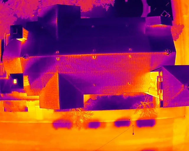
2) Thermal Roof Inspections-Harnessing cutting-edge thermal imaging technology, our drones swiftly detect hidden issues like leaks and insulation problems, ensuring thorough assessments without disrupting your daily life.
3) Orthomosaic Maps- Our software will stitch together all our photos and produce a high detailed map. It is similar to the satellite imagery we are use to but with much greater detail and updated in real time. Maps can be delivered electronically or printed.
4) 3D Models- We can produce a 3D twin of just about anything. Whether you need to capture a historical site, show off a homeplace for real estate or inspect a cell tower. Deliverables can include self hosting for online viewing or delivering the model in the format of your choice.
5) GIS services- With over a decade of experience in Geographic Information Systems we can add geospatial data to our maps. Need maps of stock water pipelines, fences or roads? No problem.
6) Cut/Fill Volumetrics- Need to know how many yards you have in a pile. Drones can quickly and efficiently calculate volumes. We can deliver full reports of cut/fill data via CSV or PDF.
7) Raw Data- Do you have your own photogrammetry software and just need data acquisition? We can assist with data capture and deliver it to you.